Virginia’s Rappahannock River served as an important battleground during the War of 1812. By 1813, British forces in Virginia were quickly gaining territory and eager to take more prizes.
On April 1, 1813, a British squadron of nine vessels formed a blockade in the Rappahannock. The following day, they sent out a series of small exploratory vessels to search for viable targets.
The expedition, led by Lieutenant James Polkington, proved fruitful when five American vessels were sighted off Windmill Point.
The exploratory party viciously pursued the five vessels all through the night. The American vessels were briefly able to evade the incoming attackers but eventually four of the five vessels were overtaken by the British.
The HMS Dolphin was a 12-gun American privateer schooner with a crew of 100 men under the command of Captain W. S. Stafford. The vessel was one of four that was captured during the Battle of the Rappahannock. The schooner resisted capture, but eventually surrendered.
The Dolphin was taken into British service and her ultimate fate remains unknown. A historical marker has been placed in White Store to commemorate the vessels captured during this battle. The marker reads:
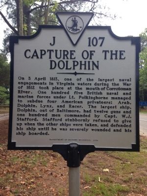
On 3 April 1813, one of the largest naval engagements in Virginia waters during the War of 1812 took place at the mouth of the Corrotoman River. One hundred five British naval and marine forces under Lt. Polkinghorne managed to subdue four American privateers: Arab, Dolphin, Lynx, and Racer. The largest ship, Dolphin, out of Baltimore, had twelve guns and one hundred men commanded by Capt. W.J. Stafford. Stafford stubbornly refused to give up when the other ships were taken, and defended his ship until he was severely wounded and his ship boarded.
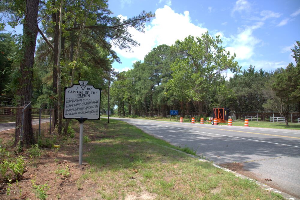
This marker is located on Mary Ball Road (Virginia Route 3) just north of the Robert O. Norris Jr. Bridge, on the right when traveling north.
Information sourced from wikipedia.com
Information sourced from wikipedia.com