
With a variety of habitats supporting birds, mammals, reptiles and amphibians, a visit to the Rappahannock River Valley National Wildlife Refuge rarely disappoints, regardless of the season.
Operated by the U.S. Fish & Wildlife Service, the Rappahannock River Valley National Wildlife Refuge (RWR) is one of 570 refuges across the country and 16 in Virginia, established for the conservation of native species dependent on its land and waters.
The RWR was established in 1996 and is currently made up of 17 smaller units, six of which are open to the public. There are roughly 10,000 acres of wetlands that surround both sides of the Rappahannock River and include habitats as varied as fresh water tidal marshes, forest swamps, upland deciduous forests, mixed pine forests and grasslands. The FWS actively manages the land, so you may see prescribed burns, mowing, timbering or replanting to restore and maintain the integrity of the habitats.
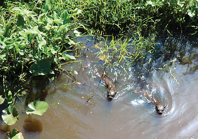
While conservation is at the heart of the refuge, recreational activities are encouraged. Depending on when you visit, the refuge is the ideal place to see migratory birds stopping on their way up and down the East Coast, to kayak among the Northern river otter, or fish for the bass, crappie or catfish teeming the waters. As fall approaches, the fairly easy walks along these trails will provide breathtaking views of color and great opportunities for wildlife observation and photography.
In addition to spotting native flora and fauna, a visit to the RWR may also include a sighting of some Rappahannock Wildlife Refuge Friends. Headed by president Steve Colangelo, the friends group “might be out driving the tractors, mowing grass, or this afternoon, I’m going to go over to Cat Point to install a kiosk. Yesterday, I was over at Hutchinson working on the kayak launch. So we volunteers do a lot of the manual work under the direction of these Fish and Wildlife Service employees.”
Given their passion and familiarity with the refuge, who better to ask about planning a visit, what to expect and what not to miss?
CAT POINT CREEK UNIT
2570 Newland Road, Warsaw
Restrooms, running water
Hiking, fishing, canoe/kayak, small electric boats
This 243-acre unit, formerly a campground and vineyard, was acquired in 2018 and opened to the public in 2023. The grapevines are long gone, replaced with trees, grasslands and other native plantings. Nearly all traces of the campground are gone as well, with just the convenience of restrooms and plenty of parking remaining.
There are easy wooded walking trails complete with waterfowl blinds for viewing waterfowl, wading birds and raptors. Near the boat launch, one trail leads to Dancing Point, with seating to enjoy the beautiful views of Cat Point Creek and Menokin Bay. A sign at the viewing area explains that this part of the RWR “is located near what is known to be the Rappahannock Tribe’s ancestral capital town and seat of government where the weroance (Algonquin word meaning leader or commander) lived. Dancing Point would have served as an important sacred space for ceremonies” and dancing, drumming and singing would have been an important part of the ceremonies and celebrations.
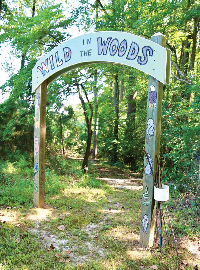
Another trail leads to Wild in the Woods, a nature-based play area for kids. “It has stumps to climb on, logs to climb on and things to crawl through,” Colangelo said. “There’s spider web netting that they can play on, sand to dig in and blocks to build with.” The quarter-mile path leading to the play area helps identify some of the trees in the surrounding woods.
Closer to the entrance and The Lodge, an Indigenous Environmental and Conservation Center owned by the Rappahannock Tribe, you’ll find mown paths through gentle hills where you can observe grassland birds and wildlife. A small freshwater pond nearby offers the opportunity to view birds, reptiles and amphibians among the pond lilies and reeds.
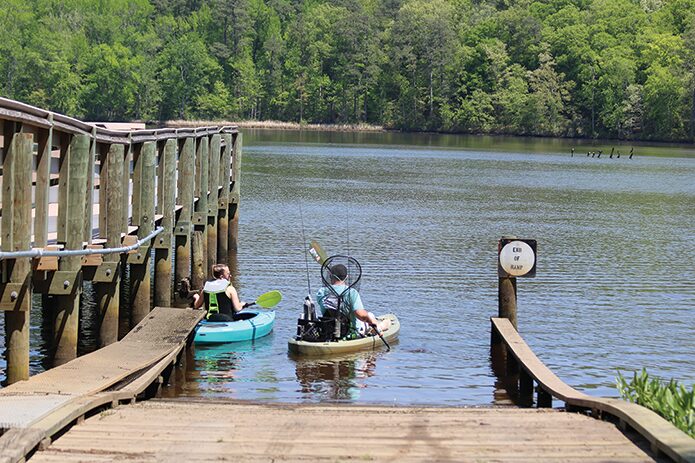
In addition to stunning views of the water, Cat Point also offers water access for boating and fishing. A fishing pier and boat launch (canoes, kayaks and electric powered boats) on Cat Point Creek/Menokin Bay is the perfect opportunity to take to the calm waters suitable for novice paddlers and immerse yourself in the surrounding nature. You may find yourself sharing the river with otters, beavers, ospreys or herons.
Cat Point Creek is on the Northern Neck Loop of the Virginia Bird & Wildlife Trail.
WILNA UNIT
336 Wilna Road, Warsaw
Rustic restrooms
Hiking, fishing, canoe/kayak, small electric boats
Just ten minutes away from Cat Point Creek, this 974-acre unit was acquired in 1996 and includes a variety of habitats including woodland, grasslands, a freshwater pond, and the tidal waters of the Rappahannock River. It also operates as the RWR headquarters.
“For visitors, the best part of Wilna is the 35-acre freshwater fishing pond,” Colangelo said. “I’m told by fishermen that it is excellent fishing.” Like Cat Point, the pond includes a small boat launch for canoes, kayaks and boats powered by electric motor. “Some people do launch small jon boats from that area, although it’s not as developed as the one at Cat Point.” A fishing pier is next to the boat launch.
A small levee with a walkway offers beautiful views of the pond, as well as native flowers in spring and summer. The easy trails offer wildlife observation decks and platforms and a butterfly wildflower garden was planted to provide food for caterpillars and host plants for larvae, typically in bloom spring to late summer.
While the unit includes frontage on the Rappahannock River, “It’s not open to the public on a normal basis,” Colangelo said. “That’s something we’d like to do eventually, and it’s something we will do when we have school groups, or other groups.”
Wilna is on the Northern Neck Loop of the Virginia Bird & Wildlife Trail.
HUTCHINSON UNIT
19180 Tidewater Trail, Tappahannock
Rustic restrooms
Hiking, pavilion with picnic tables, canoe/kayak
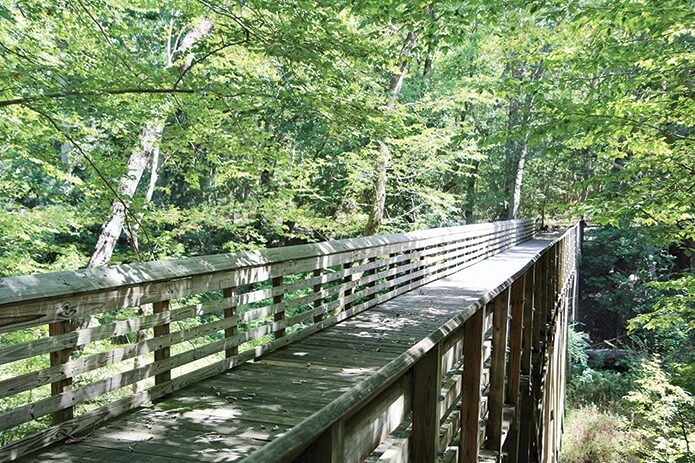
The 727 acres of this unit were acquired in 2001. “Hutchison has excellent walking trails. Out of all the various units, I think those are the nicest walking trails,” said Colangelo.
The grasslands that dominate the landscape when you enter are visited by eastern meadowlarks and northern bobwhites, depending on the season. Wildlife can be viewed from an elevated platform reached by the Bobby’s Byway Trail.
Traveling further into the refuge, you enter the 250 acres of upland forest. An elevated walkway on the Judy Allen Trail offers a glimpse into the canopy and the many songbirds that live there. It will soon offer unbeatable views of fall colors in this deciduous forest.
You can drive or hike down to the kayak launch on Mount Landing Creek, a tributary of the Rappahannock River and once the territory of the Rappahannock Tribe. According to the Interpretive signs at the trail, Mount Landing Creek may have been the tributary that John Smith traveled in 1608 when he encountered members of the Rappahannock.
The creek’s habitat is dominated by 130 acres of tidal marshes, vital for protecting shorelines and creating habitat and food for small mammals and birds.
Hutchinson is on the Northern Neck Loop of the Virginia Bird & Wildlife Trail.
LAUREL GROVE
736 Laurel Grove Road, Farnham
Rustic restrooms
Hiking, canoe/kayak
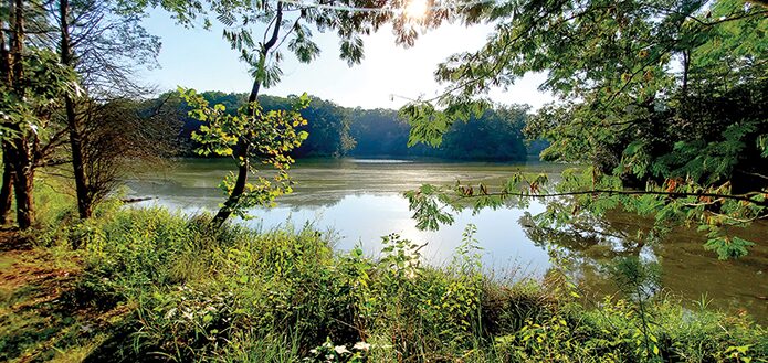
The highlight of this 1,090-acre unit acquired in 2003 is a 10-acre freshwater pond, nestled in the surrounding woodlands. An easy trail loops 1.5 miles around part of the pond where you might encounter beavers, otters, turtles and waterfowl. A photo blind facing Farnham Creek offers the opportunity to capture wood ducks, bufflehead or tundra swans as they winter in the area. Since Farnham Creek is a tributary of the Rappahannock River, you might catch a glimpse of a bald eagle or osprey.
You can explore the pond further by canoe or kayak by launching off the shore near the main entrance. Fishing is allowed.
Laurel Grove is on the Northern Neck Loop of the Virginia Bird & Wildlife Trail
Know before you go:
- All units are free and open to the public year-round from sunrise to sunset. Some closings may occur during hunting seasons.
- No pets allowed.
- Stay on the trails.
- Practice “Leave no trace.” Whatever you carry into the refuge, you carry out. Trash is disposed of at home.
Interactive map of units with trails and amenities from the U.S. Fish & Wildlife Service
The refuge is a part of the National Parks Service’s Chesapeake Gateway Network